|
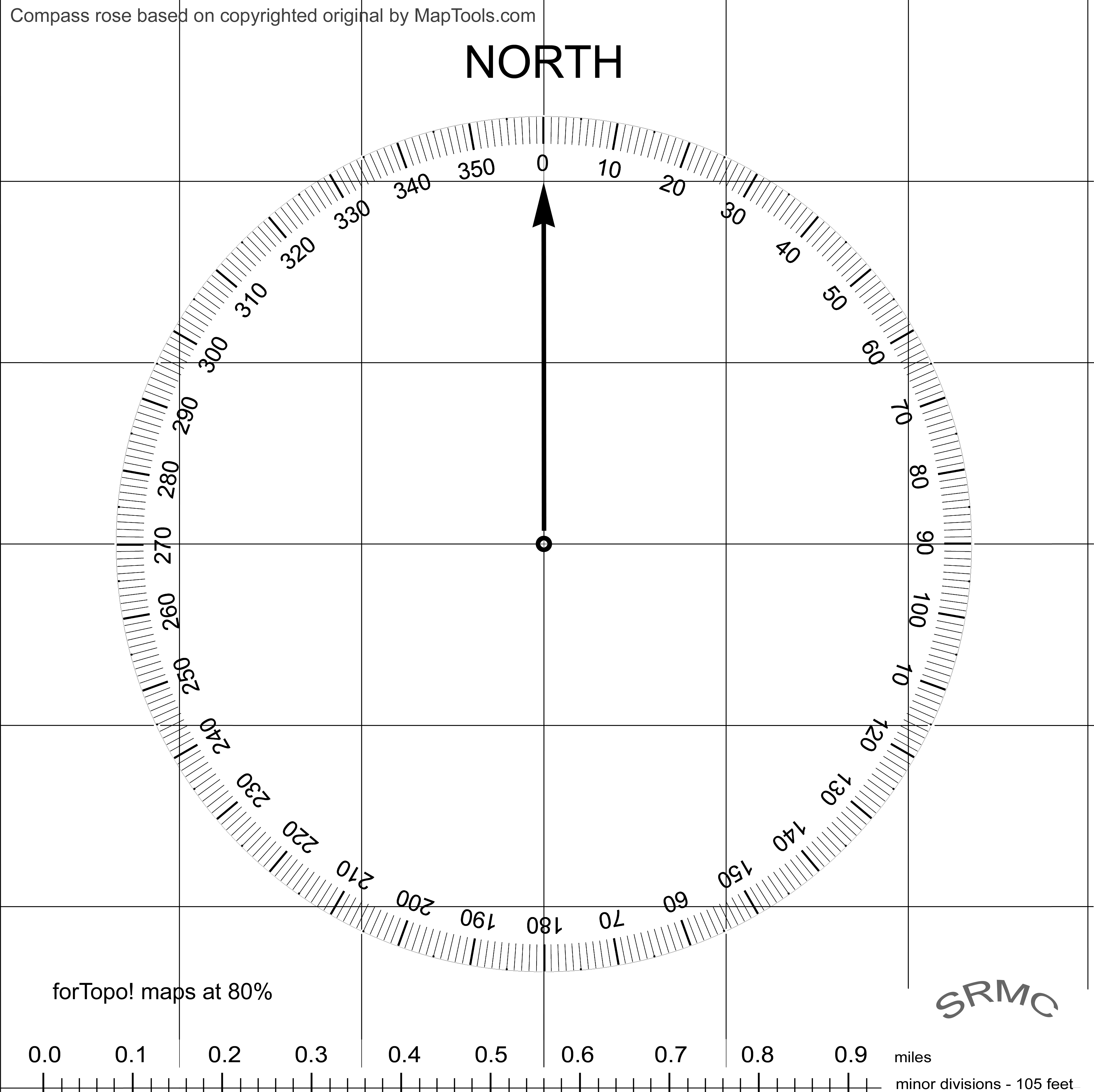
Here is a modified compass rose that can be used to find your location on a map using a GPS, and also 'project' a waypoint. There are no moving parts, it is waterproof, and it can be used standing.
The issue: the GPS can give you your current lat-lon, but converting that to an accurate point on the map is difficult, especially if the weather is bad or the lighting is poor. Say you are not sure precisely where you are and need to avoid an obstacle, a cliff for example and you do not have the necessary waypoints uploaded to the GPS.
There are awkward to near impossible ways to get the waypoints needed in the field, but here is another way, recommended for gear nuts at least. In order for this method to work you need at least one waypoint in the area that has been uploaded to the GPS that can also be found on the map. Summits are convenient for the purpose. Trailheads may or may not be accurately represented on the map so be careful using them.
The special compass rose looks like this: |
|
The scale at the bottom is designed to work with NGS Topo! maps printed at 80% but the file can be resized to work with other maps. Download the high resolution copy here. http://www.larryscascaderesource.com/pics/CompassRose.png Print it on inkjet transparency film and cover the inked side with clear Contact self adhesive laminate or similar. Punch a small hole in the very center. This will be used in marking the map.
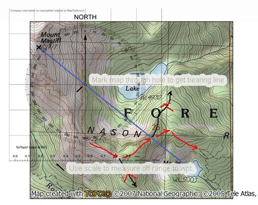
To find where you are on the map, turn the GPS on and get the range and bearing to a known waypoint, say a summit or another uploaded waypoint. The GPS should be set to generate true bearings, not magnetic. Use the special compass rose to plot your position on the map as follows. |
|
A Location Finder / Waypoint Projector |
|
Using the compass rose: While keeping the gridlines on the rose aligned with north -south or east-west lines on the map move the rose so that the compass rose mark that corresponds to the GPS bearing is over the known waypoint. (Note: some gridlines on the base USGS topographic map may be referenced to grid north; use true north.) Making sure that the rose is still aligned north-south east-west, make a small mark on the map through the hole in the center of the rose. You may use anything convenient to make the mark. A line between the known waypoint and this mark gives you the needed bearing line, although you often do not need not to actually draw it on the map. Now measure off the range from the known waypoint along the bearing line as indicated by the GPS. That's where you are. Continued....
|