|
Interactive Panoramas from the Washington Cascades |
|
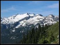
Mt. Daniel from Mac Peak |
|
What's on This Page |
|
The table below has links to interactive panoramas from the Cascade Range in Washington State as well as some older panoramas in booklet format. Many panoramas are labeled, with thanks to John Roper for reviewing them. Naming conventions below. The place name is linked to a TopoZone map. If not otherwise noted, the panoramas cover a full 360 degrees.
The old panorama booklets were originally intended for the Forest Service but nothing came of that so I have added them to the listings below.
Origins: The first panoramas from Cascade peaks I did were just for me. They were field guides with peak labels to compensate my poor memory. Friends at the Cle Elum Ranger District encouraged me to make a few pans for the two remaining fire lookouts in the district, and then one thing lead to another.
Who is this for? One of my goals was to document the Cle Elum Ranger District north of I-90 from a large number of vantage points within and along the boundary of the district. Along with the labeled panoramas in .pdf format from each of these locations, I hoped these interactive panoramas would be a useful tool for the district. |
|
Last update: March 20, 2025 |
|
*Conventions:
Callout lines with arrowheads indicate that the feature either is not visible because of an intervening feature, or because it is obscured by fog, cloud or haze. (Some of these arrowheads had to be removed when recompiling the oldest panoramas from the booklets.)
Quotation marks indicate unofficial names. In most cases they are taken from Jeff Howbert's Master Peak List, or from what I understand is common local usage. Unofficial names (in quotes) not on the Master Peak List, or not common local usage are what I understand to be first ascent names.
Names from USGS topographic maps, Green Trails maps, or from Fred Beckey's Cascade Alpine Guide (CAG) are used without quotation marks. In addition, names from the now out of print Teanaway Country by Mary Sutliff, published in 1980 by Signpost Books are used in a few cases, and are enclosed in quotation marks.
More recently and following Beckey I have indicated first ascent names by enclosing them in brackets following the name found on USGS topo maps.
When locations are identified only by the elevation, and the USGS 7.5 minute maps note the elevation without a 'T' (for transit) the elevation was typically enclosed by single quotation marks (e.g. '6755'). I have dropped the single quotation marks in the most recent panos. Callouts for ridges are usually placed at the high point on the ridge unless it extends to a higher feature. If a ridge has 2 or more callouts, the high point is usually so indicated.
A special thanks to John Roper for his help on naming issues with the labeled panoramas, some of which have more than 400 features identified. However, all errors are mine. I have tried to keep these conventions consistent, but there have been some revisions since the earliest panos. |
|
Interactive Panoramas from the Washington Cascades |
|
If the panorama is black: As of February 2025, the panoramas as well as everything else on the site now seem to work using HTTPS addresses (“secure addresses”) as well as HTTP addresses.
However if the panorama is black, remove the ‘s’ from the “https://” address for the panorama as displayed in the browser address bar. |

|
TopoZone map of panorama location |
Date photos taken |
Unlabeled |
Labeled |
Labeled panos in booklet format password if needed: “grubisa” |
|
October 2006 |
|
|
||
|
November 2006 |
|
|||
|
October 2005 |
|
|
||
|
August 2002 |
|
|
||
|
June 2009 |
|
|
||
|
August 2007 |
|
|
||
|
September 2007 |
|
|||
|
Cadet peak list |
|
|
|
|
|
|
|
|
||
|
2011 |
|
Cascades from Seattle Matt Uyttendaele pan |
|
|
|
August 2005 |
|
|||
|
August 2007 |
|
|
||
|
August 2009 |
|
The Cradle from Sprite Lake (100 deg.) |
|
|
|
August 2009 |
|
|
||
|
July 2008 |
|
|||
|
September 2004 |
|
|||
|
July 2007 |
|
|
||
|
June 2007 |
|
|
||
|
May 2008 |
|
|
||
|
June 2005 |
|
|
||
|
November 2008 |
|
|
||
|
May 2007 |
|
|
||
|
January 2007 |
|
|||
|
February 2009 |
|
View from Jolly Mtn. ski route (130 deg.) |
|
|
|
May 2008 |
|
John Morrow photos |
|
|
|
October 2007 |
|
|
||
|
|
|
|
||
|
July 04 & 06 |
||||
|
June 2010 |
|
|
||
|
April 2005 |
|
|||
|
May 2005 |
|
|
||
|
June 2006 |
|
|
||
|
October 2006 |
||||
|
August 2009 |
|
Mt. Rainier from Castle Mtn. trail (97deg,) |
|
|
|
August 2009 |
|
Mt Rainier from Crystal Mtn. Summit House (66 deg.) |
|
|
|
August 2007 |
|
|||
|
April 2007 |
|
|
||
|
July 2007 |
|
|
||
|
July 2005 |
|
|
||
|
|
|
Panther Pass (145 deg) |
|
|
|
May 2008 |
|
|
||
|
|
Point 6262 (above Minotaur Lake |
|
||
|
September 2009 |
Point 6300 (above Park Lakes) |
|
||
|
September 2009 |
Point 6300 zoomed in (310 megapixels) |
|
|
|
|
August 2006 |
|
|
||
|
September 2010 |
|
(S. of Sourdough Gap) |
|
|
|
June 2003 |
|
|||
|
October 2003 |
|
|
||
|
January 2008, 8 am |
|
|
||
|
September 2005 |
Red Mtn. (Cle Valley) |
|
|
|
|
July, 2008 |
|
|||
|
April 2021 |
|
|
||
|
|
|
|
||
|
September 2006 |
|
|
||
|
April 2008 |
|
|
||
|
August 2006 |
|
|
||
|
October 2005 |
|
|
||
|
July 2009 |
|
|
||
|
July 2007 |
|
|
||
|
September 2005 |
||||
|
October 2008 |
|
|
||
|
May 2007 |
|
|
||
|
May 2006 |
|
|
||
|
Sept. 2008 |
|
|||
|
August 2005 |
|
|||
|
September 2005 |
|
|||
|
|
|
|
|
|